


 This semester I am taking an Advanced Volcanology class focusing on hydrovolcanism. A few weeks back I was preparing a talk for phreatomagmatic fragmentation and I was going to use photos I had taken on previous excursions to the eastern Sierra. Unfortunately, I did not have any photos of what I needed, so with my free weekend camping in Mammoth Lakes sounded great to me.
I stayed in the Twin Lakes campground and spent some time visiting different geologic sites in the area. The first picture was taken from my cot and is called the Dragon's Back, a ridge extending from Mammoth Mountain. The second photo is Twin Falls. If you have never been to the Mammoth Lakes area, the Lake Mary area is an awesome place to camp. There are 6 lakes with several different campground available and Twin Falls is located between Lake Mamie and Twin Lakes. With the activity of Mammoth Mountain in the 1980's, the highest elevation lake in the area, Horseshoe Lake, has been closed due to high levels of carbon dioxide at ground level. The area reminds me of a moon landscape because all plant life has been killed. The third photo is Twin Lake.
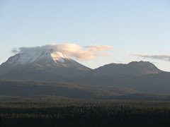
Traveling away from the Lake Mary area to the other side of the Mammoth Mountain is Minaret Summit, a place where you can see the Middle Fork of the San Joaquin River drainage, Ritter Range, and take a shuttle down to Devils Postpile National Monument during the summer time. The fourth photo is of the Ritter Range, the mountain peaks in the picture from left to right are Mt. Ritter, Mt. Davis, Rodgers Peak, and Mt. Lyell. The last photo is Mammoth Mountain, which is a major mountain biking and skiing resort destination for the Southern California area. The ski lift is visible at the top of the mountain.
More of the Mammoth Lakes area in the next blog.........

No comments:
Post a Comment