Showing posts with label Chaos Crags. Show all posts

Thursday, September 25, 2008

Lassen Peak: May 1915 lavas


Once on top, we hiked across to get an aerial view of Chaos Crags considering I was suppose to be completing field work. The 1915 eruptions produced 4 different types of lavas 1) hybrid black dacite 2) andesitic enclaves 3) a banded pumice with dark andesite and light dacite and 4) unbanded light dacite (Clynne, 1999). Sorry, I didn't get extreme close ups of the lavas, I just realized this looking through my photos, darn I will have to hike the trail again. : o ) Instead, I took the artsy approach to photographing the lava.

The stay on top was very peaceful once we hiked away from the small crowd on top. Taking in the moment of hiking across lava on an active volcano, I thought of a story I had heard involving the early eruptions of Lassen Peak. The story is about three local guys who went to investigate Lassen Peak after one of it's small eruptions. Reaching the peak, they wanted to look down the vent, only to have the volcano produce another small steam eruption that sent tephra raining down on the guys. One man got hit in the head with a block and was knocked out, while his friends ran like hell. When the activity ceased, the two friends went back to check on the one friend, who they thought would be dead. Instead, they found was he was ok with just a bump on the head. I love this story because when I go on trips to very active geologic areas I secretly hope for a volcanic eruption, large earthquake or other natural disaster. But on the other hand, what good friends he had leaving him lying there in a dangerous moment. I have been lucky enough to witness small rockfalls and feel small earthquakes on various trips but nothing on the factor I am looking for.
The first three photos are the 1915 lavas at varying locations. I pretty much hiked though the entire lava field on top, because I thought it was the shorter way to get back to the main trail! The fourth photo is the aerial view of Chaos Crags. I left Melinda to rest and set out on an adventurous hike out to the furthest point possible without falling 1000 ft to my death. I think the small ridge could of been possible but I didn't want to chance it, I am still young and have a lot of life still to live. The last photo is from Lake Helen looking northeast to the grand peak.
Clynne, M.A., 1999, A Complex Magma Mixing Origin for Rocks Erupted in 1915, Lassen Peak, California; Journal of Petrology, v. 40, 105-132.

Friday, September 12, 2008

More of the first day of field work

The loose blocks are part of the Chaos Jumbles with Dome C (straight back) and Dome D (peeking out over the trees). Hiking this area is difficult, as it is a bunch of loose blocks for miles and good balance is needed, because you will see why later.

In a previous post, I said the Chaos Jumbles were the result of Dome C collapsing around 300 years ago. When the dome collapsed it traveled down the north slope for several miles, ran up against Table Mountain on the other side of the valley, turned west and came to rest after several more miles. Manzanita Lake formed because the jumbles acted as a dam.

So back to the enclaves that are the key to my project. I really liked this enclave. It has both the medium and fine grained enclaves with host plagioclase. The size of enclaves for the Chaos Jumbles ranged from mm's to one I saw that was 2 ft, but it was the largest one I saw. Most where around a ft or smaller.


Tuesday, September 9, 2008

Field work


It has actually been awhile since I last posted a blog and I finally got to my field area. The above picture is after eating lunch in Anderson, CA at a Panda Express. I was laughing at the view, not many fast food joints have such a great view, so I figured the picture was a great way to start out the trip! If you want to know where Lassen Peak is look above my head. I was hoping that Lassen was not going to be busy and it wasn't. The weather was beautiful and the sky a wonderful blue color. So we set up camp and embarked on my reconnaissance trip of my field area.


So when we got there Wednesday afternoon, we didn't really have a plan, so we decided since I had not hiked the Chaos Jumbles in detail, that is what we would do first. A refresher, in case you forgot from previous posts, the Chaos Crags are six dacitic domes, named A-F, with Dome A, the oldest in age. The Chaos Jumbles were the result when Dome C collapsed somewhere around 300 years ago (Heiken and Eichelberger, 1980). For my field work, I am trying to figure out the magma mixing event or events. To do so, I need to look at the enclaves (blobs in the rock not of host origin) and distinguish if there are different types. So far there seems to be three different types present in each of the six domes, but I believe that there might be more variations. I think I will be able to determine this with more field work and Crystal Size Distributions (CSD).

The above picture is a fine-grained porphyritic enclave in the host dacite, as classified by Heiken and Eichelberger, 1980. The enclave is about 1 ft long, the larger crystals are resorbed plagioclase from the host dacite.

This is a medium grained porphyritic enclave also in the dacite host and once again the larger crystals are resorbed plagioclase. This enclave was smaller at around 8 in.


Heiken, G., and J.C. Eichelberger, 1980, Eruptions at Chaos Crags, Lassen Volcanic National Park, California; Journal of Volcanology and Geothermal Research, 7, 443-481.

There is still more from the first day, but you have to wait until the next post.

Sunday, July 13, 2008

Getting to know me- My thesis project

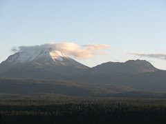
In Fall 2007, I was lucky enough to get an aerial view of my field area by hiking to the top of Lassen Peak. Keep in mind, I was on a geology field trip, where I only had two hours of free time to climb over 2,000ft and get back down. I was only 15 min. late and I can say I ran down Lassen Peak, down in about 35 min.

So my project is the Chaos Crags, located north of Lassen Peak. The crags consist of 6 rhyolitic domes that contain basaltic-andestic enclaves (which are blobs of a different type rock within the host rock). I will soon be spending many hours (that is, if the smoke from all of the fires clears) point counting these enclaves, looking for different types, size, etc. In the meantime, I am also taking digital pictures within thin-sections of these volcanic rocks and using a method called CSD distribution on plagioclase. I am old school, actually outlining plagioclase crystals within each picture using a lightbox and tracing paper, lets just say my hand and wrist hurts and I should buy stock in Sharpie pens. But I am not complaining because I can do this at home, whenever I feel like it, and it gets me more familiar with the rocks, only if my son was older, he could help me trace and color. I have tried using the computer, but I have to admit that I am not advanced enough to use a program like photoshop CS3 to outline just plagioclase crystals.