Once on top, we hiked across to get an aerial view of Chaos Crags considering I was suppose to be completing field work. The 1915 eruptions produced 4 different types of lavas 1) hybrid black dacite 2) andesitic enclaves 3) a banded pumice with dark andesite and light dacite and 4) unbanded light dacite (Clynne, 1999). Sorry, I didn't get extreme close ups of the lavas, I just realized this looking through my photos, darn I will have to hike the trail again. : o ) Instead, I took the artsy approach to photographing the lava.
The stay on top was very peaceful once we hiked away from the small crowd on top. Taking in the moment of hiking across lava on an active volcano, I thought of a story I had heard involving the early eruptions of Lassen Peak. The story is about three local guys who went to investigate Lassen Peak after one of it's small eruptions. Reaching the peak, they wanted to look down the vent, only to have the volcano produce another small steam eruption that sent tephra raining down on the guys. One man got hit in the head with a block and was knocked out, while his friends ran like hell. When the activity ceased, the two friends went back to check on the one friend, who they thought would be dead. Instead, they found was he was ok with just a bump on the head. I love this story because when I go on trips to very active geologic areas I secretly hope for a volcanic eruption, large earthquake or other natural disaster. But on the other hand, what good friends he had leaving him lying there in a dangerous moment. I have been lucky enough to witness small rockfalls and feel small earthquakes on various trips but nothing on the factor I am looking for.
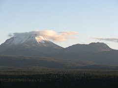
The first three photos are the 1915 lavas at varying locations. I pretty much hiked though the entire lava field on top, because I thought it was the shorter way to get back to the main trail! The fourth photo is the aerial view of Chaos Crags. I left Melinda to rest and set out on an adventurous hike out to the furthest point possible without falling 1000 ft to my death. I think the small ridge could of been possible but I didn't want to chance it, I am still young and have a lot of life still to live. The last photo is from Lake Helen looking northeast to the grand peak.
Clynne, M.A., 1999, A Complex Magma Mixing Origin for Rocks Erupted in 1915, Lassen Peak, California; Journal of Petrology, v. 40, 105-132.
 The below picture is the biggest of the three maars that comprise the Inyo Craters. The size of the crater is 600 ft wide and 200 ft deep and there is a permanent lake at the bottom of the crater. The second maar is just a little to the northeast and not quite as wide and 100 ft deep. The third maar is located on top of Deer Mountain. A maar forms when magma comes in contact with groundwater and produces violent steam explosions. Magma never reaches the surface, but the result of the steam explosion leaves a sizable crater. The eruptive phase tends to last anywhere from days up to a month. The Inyo Craters are some of the youngest volcanic features in California erupted around 550 years ago. A shallow dike is the most likely cause for the eruptions.
 The next photo reflects the type of deposits that are deposited by a phreatic eruption. These deposits are coarsely layered and exhibit poor sorting of ash to gravel size. In phreatic eruptions it is hard to determine juvenile magma, because the steam eruption will also cause non juvenile clasts to be ejected.
 This photo shows the northeast trending relationship of all three craters, but the third crater is hidden in the trees on top of Deer Mountain. The craters are believed to have erupted in sequence from north to south.
 Below is the deposits of the second biggest crater. Distinct characteristics exist between the two maars other than size. The second maar contains a smaller lake and mature trees located within the crater.
 The craters are that way! This is the trail marker at the end of the 1.2 mile dirt road. To get to the Inyo Craters: take the Mammoth Lakes Scenic Loop and travel several miles and look for the Inyo Craters sign, turn left if coming from Mammoth Mountain and follow the signs to the craters. There are many dirt trails that you could potentially get lost, always choose to the right.